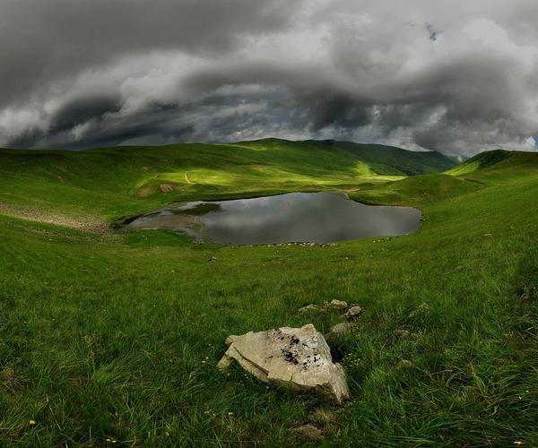
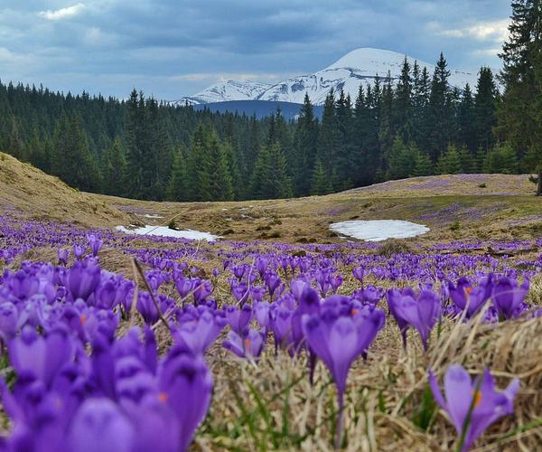
Beech grows to about 1,380 m on Svydovets, higher than anywhere else in the Ukrainian Carpathians, and the point where it gives up is abrupt: closed canopy one minute, open grass the next, the crest running away ahead of you. This is the third-highest of the Ukrainian Carpathian massifs, after Chornohora and the Marmarosy, and much the grassiest.
Chornohora takes the crowds and the altitude record. Svydovets has the water — nine glacial lakes along the north side of the main ridge — and a crest you can cross end to end in three days without once using your hands.
Apshynets ridge, Svydovets / Photo by Deffar
Fifty kilometres between two rivers
The massif runs roughly 50 km through Zakarpattia, from the Chorna Tysa in the east to the Tereblia in the west. Its shape is the opposite of the Gorgany next door: no jagged scree crests, but wide flat-topped ridges — remnants of ancient planation surfaces — cut apart by deep valleys and the occasional rock wall.
The core is protected: the Svydovets massif of the Carpathian Biosphere Reserve covers 6,580 hectares between about 600 and 1,883 m, stands of its old beech forest are on the UNESCO World Heritage list, and Emerald Network sites under the Bern Convention overlap the range, which is also brown bear and lynx country.
Morning on Svydovets / Photo by vovikmar
Nine lakes in glacial cirques
Glaciers on the northern flank gouged round rock amphitheatres out of the slope; when the ice withdrew, snowmelt and springs filled them. About nine survive, all cold enough to make swimming a dare rather than a plan.
Four have names people use, and each has its own entry here: Dohiaska (Hereshaska) at around 1,577 m, the broadest and barely knee-deep; Apshynets at 1,487 m, inside a hydrological reserve of national importance; Vorozheska at 1,460 m, two basins fed by a shrinking snow patch and going the same way as it; and Ivor near Drahobrat, the clearest.
The summits, from Blyznytsia down
Blyznytsia — the Twins — closes the eastern end at about 1,883 and 1,872 m. Western and southern slopes are walkable, eastern ones are not, and edelweiss still grows on its rocks, a botanical monument of national significance: look, photograph, leave.
Velykyi Kotel, about 1,770 m, drops a steep wall into Vorozheska. Stih, about 1,704 m, has a lift up from Drahobrat — the one summit here you reach without walking. Troiaska, 1,702 m, sits in the dead centre and sees the fewest people. Everything up there is grass; the rocky exception is the Second Zhandarm, 1,780 m, steep enough for freeriders.
Walking it, and sharing it
The full traverse runs Ust-Chorna to Yasinia or the reverse: 50–55 km over nearly every summit and past nearly every lake, three days at a decent pace, waymarked red as part of the Transcarpathian Tourist Route. The eastern half around Drahobrat is busy; the Ust-Chorna approach is not, which is the argument for walking it backwards. The easiest way onto the crest is the saddle between Blyznytsia and Stih, 10–11 km up from Drahobrat.
The mountain is worked, not empty. From late spring the polonyny fill with sheep and cattle, shepherds' kolyby stand near the paths, and the flocks come with guard dogs — working animals rather than pets. Give the herds room, and route around polonyna Ripna in the grazing season if you can.
There is no firewood up top and damaging the dwarf pine is prohibited, so cook on gas. In winter these slopes hold avalanches, and having Ukraine's highest ski resort in the middle of the range makes it feel tamer than it is. Drahobrat holds snow into May; the last stretch of road up to it needs four-wheel drive. Trains run to Yasinia, Kvasy and Rakhiv.
The argument over what Svydovets is for
Since 2016 this has been the most contested ground in the Ukrainian Carpathians. The plan that surfaced then was a ski resort on Alpine lines — over 1,400 hectares, some 60 hotels, tens of kilometres of lifts — pitched by its promoters as year-round work for villages that currently export their labour. Conservationists costed it at roughly 430 hectares of felling and lost habitat for scores of protected species, inside the Emerald Network and up against the biosphere reserve. NGO investigations name the developer as Skorzonera LLC and link it to Ihor Kolomoyskyi.
The courts closed that round. Zakarpattia's administrative court annulled the planning approvals in July 2022, an appeal court reversed it, and in October 2024 the Supreme Court's cassation chamber restored the annulment, cancelling the detailed territory plans issued by the Rakhiv and Tiachiv district administrations. No valid planning document for the resort now exists, and a complaint has sat on the Bern Convention's register since 2019.
Wind is the newer question. In June 2025 an excavator was pouring footings at nearly 1,700 m on Troiaska for a wind-speed mast installed by Vitroparky Ukrainy; in May 2026 the Yasinia and Ust-Chorna councils prepared some 800 plots covering over 8,000 hectares here and on polonyna Krasna for auction, formally for haymaking and grazing. Campaigners read the subdivision as groundwork for turbines. The other side of it is that Ukraine's grid has been badly damaged and wind is cleaner than what it replaces. On 8 July 2026 the European Parliament urged Ukraine to build wind capacity outside protected areas. Nothing is settled.
Location
Svydovets
Khrebet Svydovets', Закарпатська область, Рахівський район
Свидовець - це нереально красиві гори та полонини. На жаль, літом сюди краще не йти, але вже осінню чи зимою тут можна відчути справжній дух гір та поблукати в самотності, бо в такий час ви не побачите горе-туристів на джипах, які псують природу. Дуже багато джерел та цікавих гір. Маршрутів можна продумувати безліч і завжди побачите щось нове.
Фото з листопада 2023
Аліна Сільваші
5/5
Дуже вдалий хребет для прогулянки пішки. Найприємніше проходити його в теплу пору року. єдиний недолік - купа автотранспорту на хребту.
Андрій Довганик
5/5
Дуже красиві гори, а маршрути тут легкі й доступні. Єдиний суттєвий мінус - транспорт, що їздить по горах, і сміття.