Андрій Довганик
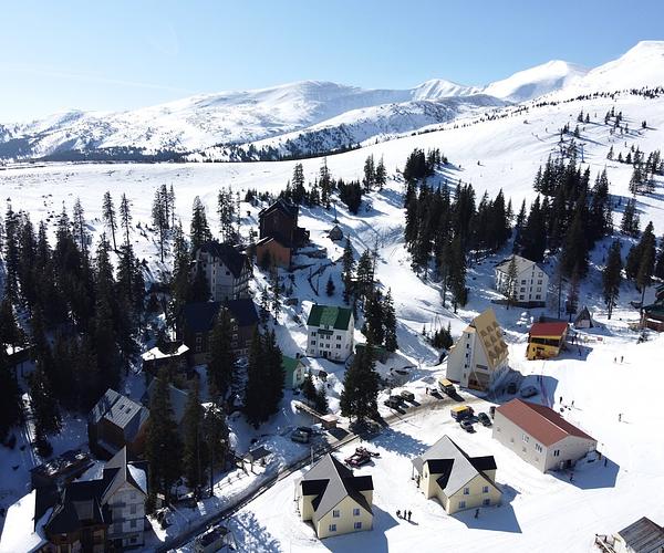
Маршрут можна пройти за кілька годин, вирушивши або від залізничної станції, або з центру селища. Дорогою відкриваються чудові краєвиди.

On 28 September 1944 the densest stretch of fortification in the Ukrainian Carpathians was given up by its defenders without a frontal assault ever being made on it. Around fifty concrete firing points stood on the slopes above Yasinia, wired together with trenches, anti-tank teeth and minefields, all of it trained on the road to the Yablunytsia Pass. Soviet troops went round the flank instead, over the Svydovets ridge, and struck the Hungarian positions from behind.
The works are still up there. Broken pillboxes, anti-tank ditches, stone teeth in the grass, the outlines of trenches — no signs, no lights, no ticket desk. This is the Árpád Line as the war left it, which is the argument for coming and also the reason it takes some effort.

Hungary built it between about 1939 and 1944 to keep the Red Army out of the Carpathians: some 600 km of works following the main range, from the Dukla Pass in the west to the Yablunytsia Pass in the east. The name honours Árpád, the Magyar prince who led his people into the Carpathian basin at the end of the 9th century.
It was never a wall. The doctrine behind it — “flexible defence”, drawn up by the Hungarian general Teofil Hárosy in 1939–40 — plugged valleys rather than ridges: small, dispersed, well-camouflaged works clustered wherever a road or a pass squeezed an attacker into a corridor, with open firing positions set apart from the shelters so a garrison could counter-attack instead of sitting under shellfire. Per kilometre it consumed five to ten times less concrete and manpower than the Maginot or Siegfried Lines. It was also never finished; most works reached 60–80% of plan. Even so, in the sector facing the Soviet 4th Ukrainian Front alone the count came to 99 strongpoints, 759 permanent firing points, 400 km of trenches and 135 km of anti-tank obstacles.

Yasinia's Hungarian name was Kőrösmező, and the village sits on the approaches to the Yablunytsia Pass, the main road into Transcarpathia. Hold it and you hold the door to the region, which is why the Kőrösmező node was fortified harder than anything else on the line.
About fifty permanent firing points went into a few dozen square kilometres, organised as nineteen strongpoints linked in a single chain, each with two or three firing positions, each able to shoot in any direction and to talk to its neighbours by telephone. Between them ran belts of anti-tank teeth, one-man concrete rifle posts, trenches and wire. Concrete shelters cut into the slopes served as stores, barracks, command posts and field hospitals, so a garrison could fight on unsupplied for a long time. The road to the pass was covered from several levels, with minefields and felled timber laid in front of it.
The East Carpathian offensive opened on 8 September 1944 and ran until 28 October. Soviet commanders declined the head-on attack this ground was designed to punish and sent troops across the Svydovets ridge to strike from the rear. Kőrösmező fell on 28 September. Calling that a bloodless collapse would be wrong: the defenders lost up to two-thirds of their strength before withdrawing. The line was outmanoeuvred, not walked past.
The ridge that decided it is the same one walkers cross today on their way to the Svydovets lakes.

One bunker can be reached without local knowledge. It stands on Mt Heredzhivka (818 m), on the yellow-marked trail that leaves Yasinia for Mt Petros. The trail starts off the H-09 road at about 48.25106N, 24.34931E, crosses the railway, then climbs on yellow blazes; the bunker is at 48.25434N, 24.36460E. If the concrete underwhelms you, the view back over Yasinia will not.
Everything else is scattered across the slopes with no waymarking whatever. Go with a local guide or arrive with exact coordinates — without one or the other you will spend the day in the trees. Then the standard rules for ground like this: don't enter an underground chamber alone or without a torch, wear boots, and leave metal objects where you find them, because 1944 ordnance still comes out of these hills.
If you would rather see the line without the bushwhacking, the restored sites are elsewhere: the underground complex at Verkhnia Hrabivnytsia near Volovets, walkable with a guide, and the open-air museum at Kolochava, with four rebuilt bunkers and a hundred metres of concrete pyramids. Yasinia has neither. It has the ground.
Маршрут можна пройти за кілька годин, вирушивши або від залізничної станції, або з центру селища. Дорогою відкриваються чудові краєвиди.
Пейзажі тут просто неймовірні 🥰

Чудове місце для відпочинку, все сподобалося. Атмосфера приємна, а враження залишилися тільки позитивні.